BY BILL PICTURE
Nearly 20 years ago, port officials in San Francisco began assessing the City’s underused (and largely dilapidated) southern waterfront to decide on the best path forward for the once thriving area.
During that assessment, stakeholders wanted to find an industrial-recreational balance that would honor the area’s rich maritime history. At the same time, they wanted to create jobs, make the area more accessible to San Franciscans, align the area with the City’s growing commitment to sustainability, and restore precious wildlife habitat displaced by previous commercial activity.
The effort to revitalize the area is paying off. One very visible sign of the changes is the Pier 80-96 Maritime Eco-Industrial Center, also called the MEC. “The idea behind MEC was to foster some symbiotic relationships that would better the area and the community through sustainable practices and economic development,” said David Beaupre, senior waterfront planner at the Port of San Francisco.
The acres-large slice of water’s-edge land wedged between 25th Street, Cargo Way, Illinois Street and the San Francisco Bay now hosts a dynamic and ever-growing, largely green-leaning mix of maritime-oriented businesses, mixed-used developments and public space. It’s also now home to many species of birds and other wildlife.
A good example of the symbiotic relationships that the port envisioned is the one between MEC tenants Lehigh Hanson, Cemex and Central Concrete. Lehigh Hanson imports rock and sand from its quarries in British Columbia that Cemex and Central Concrete then purchase to add to cement to make the concrete used in construction projects. Last year, nearly 1.4 million metric tons of aggregate came in through the port—600,000 tons of it through Pier 94 alone. And the concrete produced at MEC has been poured everywhere from Salesforce Tower to the new Chase Center.
“Before this, the aggregate was trucked over from the East Bay and South Bay, and any extra would usually get trucked back,” Beaupre said. “Now it comes over the waterways, eliminating all those trucks and the emissions they put into the air.”
Speaking of water, water is another key ingredient in making concrete, and both plants were designed to capture rainwater for use in the batching process. “Rather than using Hetch Hetchy water for this during the rainy months, everything that lands on these sites is captured and gets used for that purpose,” said Beaupre.
The added benefit, said Beaupre, is that this keeps rainwater from overtaxing San Francisco’s combined sewer system during the storm season. When stormwater exceeds the capacity of the City’s sewage treatment plants, a noxious mix of wastewater and stormwater, which picks up oil, pesticides and other surface contaminants on its way to the gutters, receives only minimal treatment before it is discharged into the delicate ocean ecosystem. “So anytime we can keep water out of the gutters, that’s a good thing.”
MEC’s tenants also include a company that processes used cooking oil and other meat by-products and ships them all over the world for a variety of personal, commercial and industrial uses; another company that exports electric vehicles; and a 185,000-square-foot sorting facility where recyclables collected all over the City are separated before being shipped to paper mills, glass plants and other manufacturers that purchase recycled materials.
“Sustainability is a common thread, but these companies are also all water-dependent,” Beaupre said. “As a port, we want to support maritime cargo operations, so companies that need access to the water for shipping and/or receiving get the highest priority.”
What’s good for the environment is also good for the community
The more commercial activity there is along the waterfront, the more jobs are created. And a commitment to hire locally earns a business looking to lease port-run space along the southern waterfront several extra brownie points.
“They’ve created over 1,000 jobs in the area,” Beaupre said. “And we’re talking about everything from union labor jobs to truck driver jobs.” To heighten economic growth at the most local level, tenants are also required to utilize the services of local businesses, such as trucking companies.
While net-positivity—that is, doing business in a way that benefits society and protects the environment—is important, Beaupre says the goal is even more simple than that. “Be a good neighbor,” he said.
By “neighbor,” he not only means residents, but also the wildlife that called the southern waterfront home long before industry set up along it shores. Thanks to ongoing cleanup efforts, including removing decaying piles treated with a toxic chemical that made the wood water-resistant but leaches into the water, wildlife is returning to the area.
According to the Golden Gate Audubon Society, the San Francisco Bay is an important stop for migrating shorebirds, who stop here to feed and rest. Over 184 different species of birds, including the Peregrine falcon, have been spotted at Heron’s Head Park. The 22-acre site is one of the few wetlands on San Francisco’s shoreline.
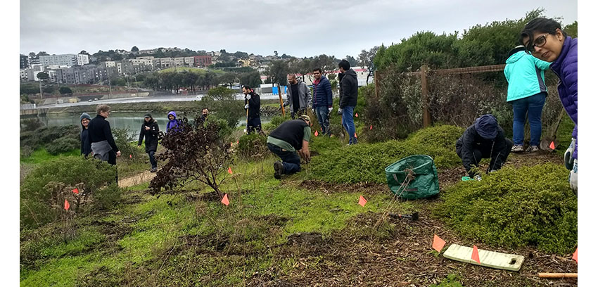
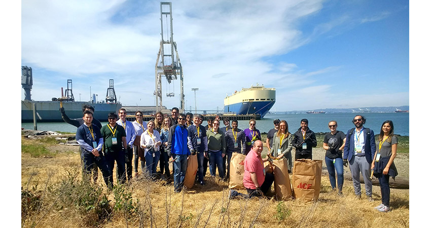
“Once access was restored to waterfront areas, people started using them almost immediately,” Beaupre said. “There’s a lot of great programming now, and it’s great to see how many people turn out for the monthly work parties to help maintain these open spaces.”
The Golden Gate Audubon Society organizes the monthly meetups, where volunteers help remove invasive plant species, pick up trash and plant more native plants.
San Franciscans’ recently rediscovered love of the waterfront has further strengthened the port’s resolve to protect it from threats posed by earthquakes and sea-level rise. “We’re very much in the research phase, I’d say; but we’re looking at employing some pretty state-of-the-art methods to adapt these areas for the next 20 to 30 years,” said Beaupre.
The Islais Creek shoreline has already been identified as being particularly vulnerable to coastal flooding. “And that has a lot of impacts, including to San Francisco’s transportation infrastructure,” Beaupre said.
MUNI’s T line crosses Islais Creek, connecting the Hunter’s Point neighborhood with downtown. “These waterfront areas are all assets; and we’re looking to strengthen those assets and make them more resilient.”